It looks like there are thunderstorms and perhaps some more scary weather related issues coming our way! According to The Weather Channel, severe thunderstorms are heading our way.
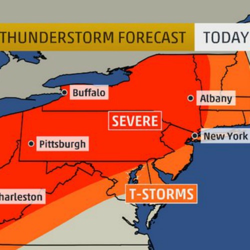
The threat continues Tuesday ahead of the advancing cold front. Scattered strong to severe thunderstorms will threaten areas from the mid-Mississippi Valley and Ohio Valley to mainly the interior Northeast. A few spotty severe storms are possible even farther east toward the Philadelphia and New York City areas as well as parts of New England.
Damaging winds and hail will again be the main threats, however, a few tornadoes cannot be ruled out.
See Dr. Greg Forbes's TOR:CON tornado forecast for a state-by-state breakdown of areas at risk of tornadoes over the next several days.
Lightning is of course always dangerous. Keep that in mind if you have outdoor plans in the orange areas on our thunderstorm maps.
For the entire report, click here.